River and Waterway Monitoring
Monitor river and waterway changes with existing cameras.
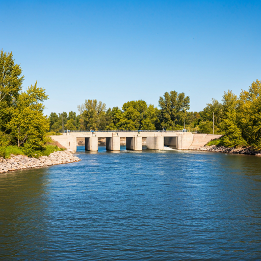
ABYSS analyzes footage from river cameras, drainage channels, canals, retention ponds, and flood-control structures. It supports remote monitoring by detecting visible changes in water-surface conditions.
For municipalities, river managers, CCTV integrators, and drone patrol teams, see the dedicated ABYSS River solution page.
24/7
Monitoring
PoC
Video First
AI
Water Vision
Operational Challenge
Rivers and waterways can change quickly during rainfall. Human patrols and periodic checks may miss night-time, remote, or weather-driven changes that require early awareness.
Target Anomalies
- Rapid water-level rise and overflow precursors
- Turbidity, color changes, and sediment inflow
- Debris, trash, and obstacle accumulation
- Unusual ripples, flow direction, and flow-speed changes
How ABYSS Starts
ABYSS compares normal and abnormal water-surface states from existing cameras or recorded footage, then applies fluid-specialized AI to surface visible change candidates that support field decisions.
Municipal and Infrastructure Use
Move beyond public live viewing into operational monitoring.
ABYSS is not positioned as a public river live-camera service. It helps municipal, facility-management, and infrastructure teams use existing footage to review water-surface changes, prioritize field checks, and keep visual records for operational decisions.
Municipal response
Review rainfall-driven water-level rise, turbidity, and debris candidates to prioritize patrols or on-site confirmation.
Channel maintenance
Surface trash accumulation, stagnant flow, or overflow precursors from routine camera footage.
Retention ponds and gates
Check reference markers, inflow changes, and reflection conditions before defining alert rules.
Existing camera PoC
Validate current camera angle, resolution, and night visibility before adding new hardware.
PoC Flow
Start with river footage, then define the notification workflow.
The first step is to check whether the target change is visible and whether the current camera conditions are usable.
Review target scenes
Identify river cameras, channels, canals, retention ponds, floodgates, or drainage scenes to monitor.
Validate with footage
Use normal and rainfall-event footage to test whether water-level changes, turbidity, debris, or ripples can be detected reliably.
Define alert operations
Decide who receives alerts, what threshold matters, and how the detection should fit flood-prevention or infrastructure operations.
FAQ
Frequently Asked Questions
Can we start with existing river cameras?
Yes. We first check camera angle, resolution, night lighting, and visibility during rain. Recorded footage is enough for an initial validation.
Does ABYSS replace water-level gauges?
No. ABYSS is best used as an additional visual layer that surfaces water-surface change candidates and gives teams more context for decisions.
What is needed to estimate flow rate?
ABYSS can visualize surface-flow direction and speed changes from video. Treating those changes as flow-rate estimates requires cross-section, depth, level-marker, terrain, or gauge data.
Can ABYSS surface driftwood, ice, or trash candidates?
Yes, when the target is visible in the footage. Object-specific identification may require customization or a downstream object-detection or vision-language model.
How is this different from a public river live camera?
ABYSS is not a public viewing camera service. It is a monitoring support layer for municipalities, facility managers, and infrastructure teams that need to review water-surface changes, turbidity, and debris candidates for initial response and record review.
Where should a municipality or infrastructure team start?
Start with rivers, canals, drainage channels, retention ponds, floodgates, or outfalls that already have cameras. The first check is whether rainfall, water-level changes, turbidity, or debris candidates are visible enough in recorded footage.
What should be checked before a river-monitoring PoC?
Check camera angle, night lighting, rain or fog visibility, water reflection, reference markers, known terrain information, and the alert thresholds the operation wants to use.
Want to test ABYSS on river or waterway footage?
Download the deck or schedule a meeting to review your camera scene and first validation path.